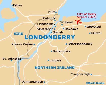
City of Derry Airport (LDY)
Orientation and Maps
(County Derry, Northern Ireland)
The city of Londonderry is often known simply as 'Derry' for short and lies on the north-eastern side of Northern Ireland. Located alongside the winding River Foyle, Derry is a spreading city with a population of more than 80,000 inhabitants and is one of the biggest cities in the whole of Northern Ireland.
On the north-eastern outskirts of Londonderry, the City of Derry Airport (LDY) stands is the small village of Eglinton, which features a population of just over 3,000. Sited close to Lough Foyle, the Derry Airport serves approximately 400,000 passengers per annum and began its life in the 1940s.
City of Derry Airport (LDY) Maps: Important City Districts
Derry contains of a number of waterfront attractions, with the 'Cityside' district being located on the western side of the city, and the 'Waterside' district on the eastern side. Both parts of Londonderry are linked by two prominent bridges, the modern Foyle Bridge, which dates back to the 1980s, and the older Craigavon Bridge, which was built in 1920.
The very heart of Derry is a particularly historic spot and contains many old buildings, such as the Guildhall along Shipquay Street, and nearby, St. Columb's Cathedral. Dating back to the 1600s, the four main thoroughfares in the city radiate outwards from the Diamond area to the gateways in the ancient walls. These old gates are Bishop's Gate, Butcher's Gate, Ferryquay Gate and also Shipquay Gate.
Northern Ireland Map

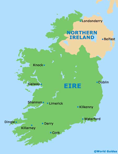
County Derry Map